Enhance your Toolset OpenStreetMap Maps with advanced features
Take your Toolset Maps to the next level with OpenStreetMap and the Toolset Maps Custom OSM plugin. This powerful plugin adds professional mapping features to your fully integrated Toolset Maps with OpenStreetMap with simple shortcodes.
New in Version 4.0
New Topography Layer: Perfect for nature and sports sites.
Improved UI: New Satellite and Topography image buttons.
Performance Boost: Decoupled loading logic ensures zero console errors on pages without maps.
Full Gutenberg Integration
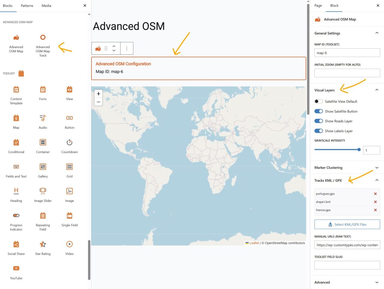
While the plugin remains fully compatible with classic shortcodes, we are excited to introduce Native Gutenberg Blocks. This update makes it easier than ever to customize your maps through a visual interface.
Advanced OSM Map Block: Configure map IDs, satellite views, clustering, and brand colors directly from the WordPress editor sidebar. No more manual attribute typing.
Dynamic Track Loader Block: Designed specifically for Toolset Content Templates and Query Loops. Easily link your KML or GPX file fields to any map with a few clicks.
Visual Track Management: Manage your path files visually. You can now select multiple KML/GPX files directly from the WordPress Media Library and see them listed within the block settings.
Toolset Maps OpenStreetMap with kml or gpx via custom field
It is possible to add kml or gpx via a Toolset Types’ file upload custom field (it can be a multiple instances field) associated to a custom post type. It is possible to display it in Single Post’s template or in a View loop.
Insert the shortcode before or after your Toolset map
Customize the appearance with the available attributes
How to Use with Blocks
Place your Map: Use the standard Toolset Map block to render your map.
Add Configuration: Insert the Advanced OSM Map block anywhere on the page and match the Map ID.
Dynamic Content: If you are in a Toolset View or Template, use the Dynamic Track Loader block to automatically display tracks stored in your custom fields.
Complete Attribute Reference:
[aotm-advanced-osm-map]
map-id: (Required) Must match your Toolset map ID
satellite: “on” – Toggle satellite base layer (default off)
To provide the best experiences, we use technologies like cookies to store and/or access device information. Consenting to these technologies will allow us to process data such as browsing behavior or unique IDs on this site. Not consenting or withdrawing consent, may adversely affect certain features and functions.
Functional
Always active
The technical storage or access is strictly necessary for the legitimate purpose of enabling the use of a specific service explicitly requested by the subscriber or user, or for the sole purpose of carrying out the transmission of a communication over an electronic communications network.
Preferences
The technical storage or access is necessary for the legitimate purpose of storing preferences that are not requested by the subscriber or user.
Statistics
The technical storage or access that is used exclusively for statistical purposes.The technical storage or access that is used exclusively for anonymous statistical purposes. Without a subpoena, voluntary compliance on the part of your Internet Service Provider, or additional records from a third party, information stored or retrieved for this purpose alone cannot usually be used to identify you.
Marketing
The technical storage or access is required to create user profiles to send advertising, or to track the user on a website or across several websites for similar marketing purposes.